Quality of Work
Tree Protection Plans
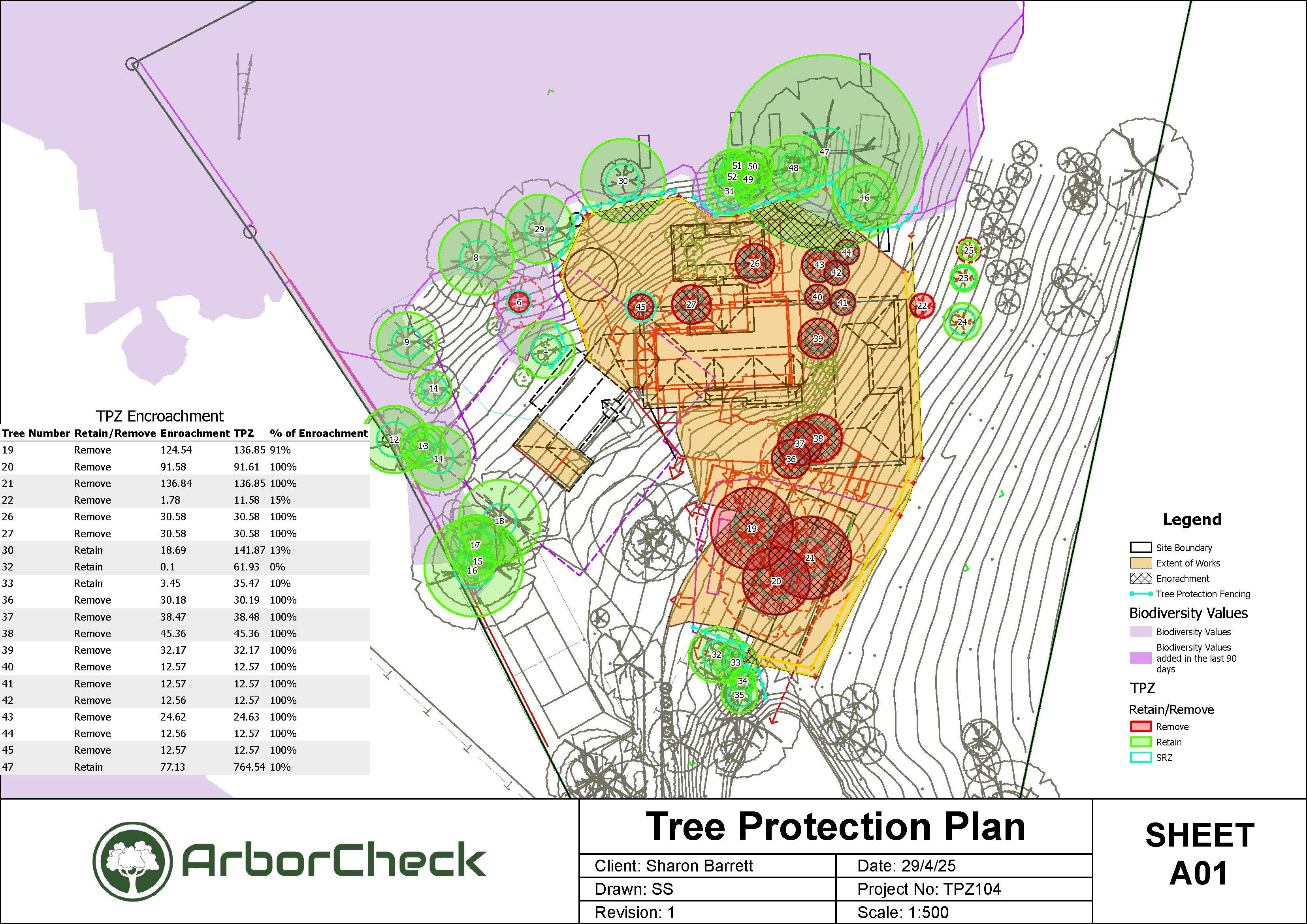
We leverage GIS, AutoCAD Civil 3D and drone-derived survey data to create pin-point accurate Tree Protection Plans that planners, certifiers and site crews can interpret at a glance. Every drawing clearly overlays canopy spreads, TPZ/SRZ footprints, service trenches and staging zones on your latest architectural or civil set—eliminating clashes before they reach site. Colour-coded symbology, schedule summaries and automated encroachment tables keep compliance with AS 4970-2009 transparent and defensible.
Reporting
Our reports read like a well-structured town-planning submission—because they are built by arborists who also speak the language of LEPs, DCPs and the relevant Australian Standards (AS 4970-2009 for tree protection, AS 4373-2007 for pruning, and AS 4687-2007 for temporary fencing). Each document pairs plain-English conclusions with high-resolution maps and photo-referenced appendices generated directly from our field-data platform, ensuring councils receive precisely the information they need—no more, no less. The result: fewer RFIs, faster approvals and absolute clarity for everyone from the project manager to the site foreman.